

The Lincoln
Highway was the first transcontinental highway in the United States which went from
coast to coast going from San Francisco to New York. The states and towns it
went through were:
California: Oakland,
Hayward, Livermore, Tracy, Stockton, Sacramento, Roseville, Folsom, Auburn,
Placerville, and Truckee
Nevada: Carson
City, Reno, Fernley, Fallon, Austin, Eureka and Ely
Utah: Great Salt Lake Desert, Grantsville, Salt
Lake City and Coalville
Wyoming: Evanston,
Green River, Rock Springs, Rawlins, Medicine Bow, Laramie and Cheyenne
Colorado had
a branch of the highway that went from Cheyenne, WY to Big Springs, NE: Fort
Collins, Loveland, Longmont, Denver, Fort Morgan, and Sterling
Nebraska: Sidney,
North Platte, Kearney, Grand Island, Columbus and Omaha
Iowa: Ames, Marshalltown,
Cedar Rapids and Clinton
Illinois: Aurora
and Joilet
Indiana: Valparaiso,
La Porte, South Bend, Elkhart and Fort Wayne
Ohio: Lima, Upper
Sandusky, Mansfield, Canton, and East Liverpool in Ohio
Pennsylvania:
Pittsburgh, Gettysburg, York, Lancaster and Philadelphia
New Jersey:
Trenton, Newark, Jersey City and finally to New York City.
The highway
was originally 3,389 miles long.
The Lincoln
Highway's history was started by Carl Fisher and Henry Joy, who had proposed a
coast to coast highway. This highway was dedicated on October 31st 1913 as a
memorial to the 16th President of the United States Abraham Lincoln.
The highway
was not all paved, in fact some of the road was still dirt in portions of the
country, especially in Iowa and the area in between Joilet, Illinois and
California. Because of that, many changes were made to the highway over the
years such as paving roads, straightening them, and adding links such as the
Carquinez Bridge in Vallejo linking Sacramento to San Francisco without going
through Stockton.
In
California, there were two branches of the Lincoln Highway: the Pioneer Branch
which went through Mills (now Rancho Cordova), Folsom, and El Dorado County.
The Lincoln Highway was the predecessor of the Interstate 80 that was to come.
In El Dorado
County, the highway went through the old town of Clarksville, the towns of Shingle
Springs, El Dorado, Placerville, Camino, Riverton, Kyburz, Strawberry, and
Meyers
The routes
it went through in the county are the present day:

White Rock
Road, Old Bass Lake Grade, Country Club Drive in Cameron Park, Durock Road,
Mother Lode Drive, Pleasant Valley Road, Forni Road, Placerville Drive, Main
Street, Broadway, the route of modern US 50 to Five Mile House, Carson Road,
Pony Express Trail, Modern US 50 from Pacific House to Johnson Pass, and
Pioneer Trail from Meyers.
I first
heard about the Lincoln Highway from Ken Allen, one of my family's longtime
friend, talking about where it went and
what it was like. When I heard about it, I was eager to take a tour of the old
Lincoln Highway and see what it was like.
 He finally
took us on a tour a year later of the highway which we saw the route and the
remnants of the old road. On the trip, we saw the old route of the highway from
old Clarksville to Placerville.
He finally
took us on a tour a year later of the highway which we saw the route and the
remnants of the old road. On the trip, we saw the old route of the highway from
old Clarksville to Placerville. A few months
later, I looked at old maps that Mr. Allen gave me after the tour and I was
fascinated at what the old highways looked like. Because of that interest, my
family and I toured the old Rusch House in Citrus Heights which was one of the
first houses in the area and saw exhibits about the history of Citrus Heights
at the house. Citrus Heights was on the old Lincoln Highway.
A few months
later, I looked at old maps that Mr. Allen gave me after the tour and I was
fascinated at what the old highways looked like. Because of that interest, my
family and I toured the old Rusch House in Citrus Heights which was one of the
first houses in the area and saw exhibits about the history of Citrus Heights
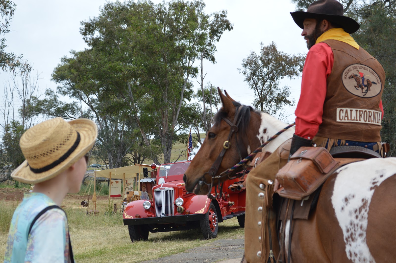
at the house. Citrus Heights was on the old Lincoln Highway.  On May 5th,
we went to the fun Clarksville Days at the historic town of Clarksville, a few
blocks away from the modern El Dorado Hills Town Center off of White Rock Road
on the old Lincoln Highway. While we were there, we saw old cars, the old
buildings and the remnants of them in the town, people riding on horses, and a
fun model train set.
On May 5th,
we went to the fun Clarksville Days at the historic town of Clarksville, a few
blocks away from the modern El Dorado Hills Town Center off of White Rock Road
on the old Lincoln Highway. While we were there, we saw old cars, the old
buildings and the remnants of them in the town, people riding on horses, and a
fun model train set.
It was a
blast learning about the old highway and the history of our area and I hope
that you can learn about it also.
I learned
about the Lincoln Highway from:
The Lincoln
Highway Association's website: https://www.lincolnhighwayassoc.org/.
The El Dorado County A Pictorial History Book
by Lisa M. Butler and Jon McCabe
The History of A Place Called Rescue book from
Francis Carpenter and William C. Teie
The Citrus
Heights Images of America Book by Jim Van Maren
the El Dorado History Museum on Placerville
Drive
the Lincoln
Highway Main Street Across America book by Drake Hokanson
the NETR Historical Aerials website
some of the old
California maps from Shell, Chevron, Texaco, and the old Richfield gas station.


Make me to know your ways, O LORD; teach me your paths. Lead me in your truth and teach me, for you are the God of my salvation; for you I wait all the day long. Psalm 25:4-5
No comments:
Post a Comment
Note: Only a member of this blog may post a comment.